Common symbols on a Topo map
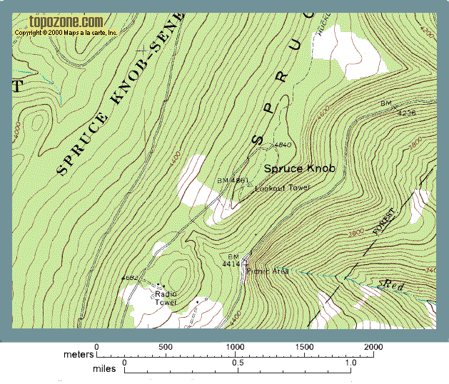
This section of a topographic map illustrates many of the common symbols used on topo maps. The map is repeated below with many of these symbols labeled.
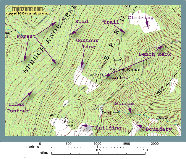
Some of the more common and important topographic map symbols have been pointed out by the purple arrows. More details are given in the text below.
MAP SYMBOLS
First lets recognize that map symbols are color coded. Symbols in green indicate vegetation, symbols in blue represent water, brown is used for topographic symbols, man made features are shown in black or red. Lets look at the symbols labeled in the map above:
Contour Lines
Contour lines are lines that indicate elevation. These are the lines that show the topography on the map. They are discussed in more detail in the next section. Contour lines are shown in brown. Two types of contour lines are shown. Regular contour lines are the thinner brown lines, index contour lines are the thicker brown lines. The numbers written in brown along the contour lines indicate elevation of the line. For this map elevation is in feet above sea level.
Forests and Clearings
Forested areas are represented by areas shaded green; for Spruce Knob this means most of the area. Areas that are not forested are left unshaded (white). Note that not all topographic maps show forests. Also note that this information is not always up to date or accurate. I have struggled to walk across densely wooded areas in places that have been mapped as "clearings".
Streams
Streams and other water features are shown in blue.
Roads and Trails
Man made features are shown in black or red. Trails are represented as thin single dashed lines. Roads are represented as double lines or thicker red lines. A series of symbols are used for roads to indicate the road quality; from double dashed lines for dirt roads to thick red lines for major highways. In the case of the Spruce Knob area we have two types of road, the thin double black lines and the thin dashed double lines.
Buildings
Like other man made features buildings are shown in black. Solid squares usually indicate buildings that would be inhabited by people (i.e. a house), hollow shapes usually indicate uninhabited buildings (for example, a barn) (Note this may not hold for maps in the future because it is not possible to determine what a building is used for from the aerial photos used to make the maps). Other man made features shown in black on our example include the lookout tower on at the summit of Spruce Knob and the radio tower. Though not seen on our map, larger buildings, such as factories, are shown by larger shapes that outline the shape of the building, and cities with closely spaced houses are shaded pink instead of showing individual houses.
Boundaries
Even though these are not physical features you can see on the ground, boundaries are shown on topographic maps by black or red lines. Boundaries are usually represented by broken lines (combinations of dots and dashes of different sizes). Different patterns are used for different types of boundaries (i.e., state, county, city, etc). On our example the boundary that is shown marks the edge of a National Forest.
Bench Marks
Bench marks indicate places where the elevation has actually been surveyed. These locations are indicated on the map by a triangle if a marker has been placed in the ground (see photo on right), or an "x" if no marker was left behind. Near either symbol are the letters "BM" and a number which represents the elevation of that particular location. Bench marks are shown in black on topographic maps.
There are many different types of map symbols used on topographic maps. Some are very common, some very rare. For a more complete list of map symbols visit the USGS web site using the link below.
|
|
Back to previous page | Back to home page |
Next page |
|