Streams and Stream Valleys
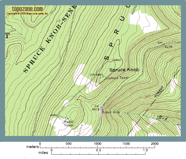
Look at the map below of the Spruce Knob area. Where are the stream valleys? Scroll down to find out.

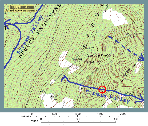
The blue lines outlining the streams on the map below have arrows showing which way the stream is flowing. There are two ways to figure this out. First you can look at the elevation of the contour lines that cross the stream. Water will always flow down hill so the elevation of the contour lines will decrease in the direction water is flowing.
The second way to tell is to look at the pattern of the contour lines. Because streams will sit in a valley, the land on either side of them will be higher. As a result the contour lines form a "V" pattern like the one in the red circle on the map below. The point of the "V" points up stream. The open end of the "V" faces downstream. It is the presence of this "V" pattern that was used to recognize stream valleys where no stream was shown on the map.
Notice that one stream has been marked with a broken blue line. There is no obvious "V" pattern to the contour lines in this valley, but instead there is a broad curve in the contours. There probably is not a single stream in this area, but water would flow down slope in this general area until it reached a better defined stream channel.
