Township and Range
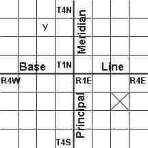
The Township and Range system, sometimes called the Public Lands Survey System, was developed to help parcel out western lands as the country expanded. The system takes many western states and divides them up using a base line and a principal meridian:
 (FIGURE 1)
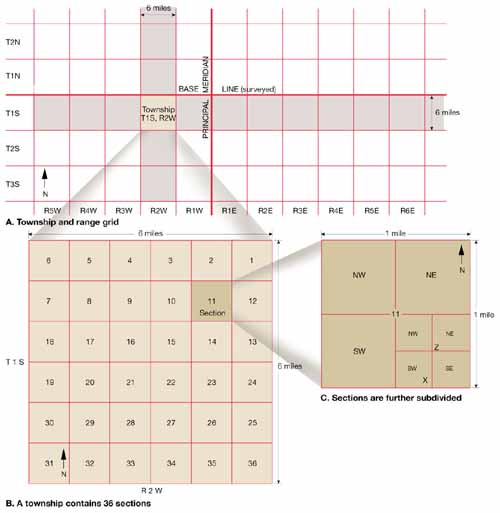
As you go to the east or west of the principal meridian, the range increases in that direction. If you go north or south of the base line, the township increases. This system divides the land up into townships and ranges that are 36 square miles each. In the diagram above, the square with the X in it would be defined as township 2 south, range 3 east The proper terminology is: T.2S, R.3E Each township and range is then subdivided into 36 sections. Each section is one mile square.
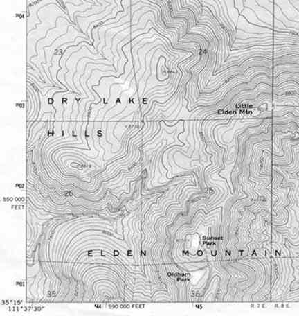
On a topographic map, you will notice a grid with red lines and text crisscrossing the map. The lines represent the boarders of the various sections in the township and range of that area. In the map below you can see sections 23, 24, 26 and 25 of T.22N, R.7E.
 (FIGURE 2)
One mile square doesn't specify a location very well, so individual sections are then subdivided into half sections and quarter sections and so on. Look at point "x" on "part c" of figure 3 below. It's location is given as: the southwest quarter of the southeast quarter of section 11 in Township 1 south and Range 2 west. The correct notation for location "x" is:
SW 1/4, SE 1/4, Sec 11,T1S, R2W
 (FIGURE 3)